BSENSED
Digital twin from multi-sensor data for enhanced border surveillance and situational awareness
About
BSENSED is a research project for the development of a digital twin from multi-sensor data for enhanced border surveillance and situational awareness.
Team
BSENSED is developed by a multidisciplinary team from Instituto Superior Técnico of Universidade de Lisboa, Portugal.
Funding
BSENSED is funded by FRONTEX under call 2024/CFP/INNOVATE/01 Novel Technologies for Futureproofing the EU External Borders (Open Theme) | (GA 2025/276).
Summary
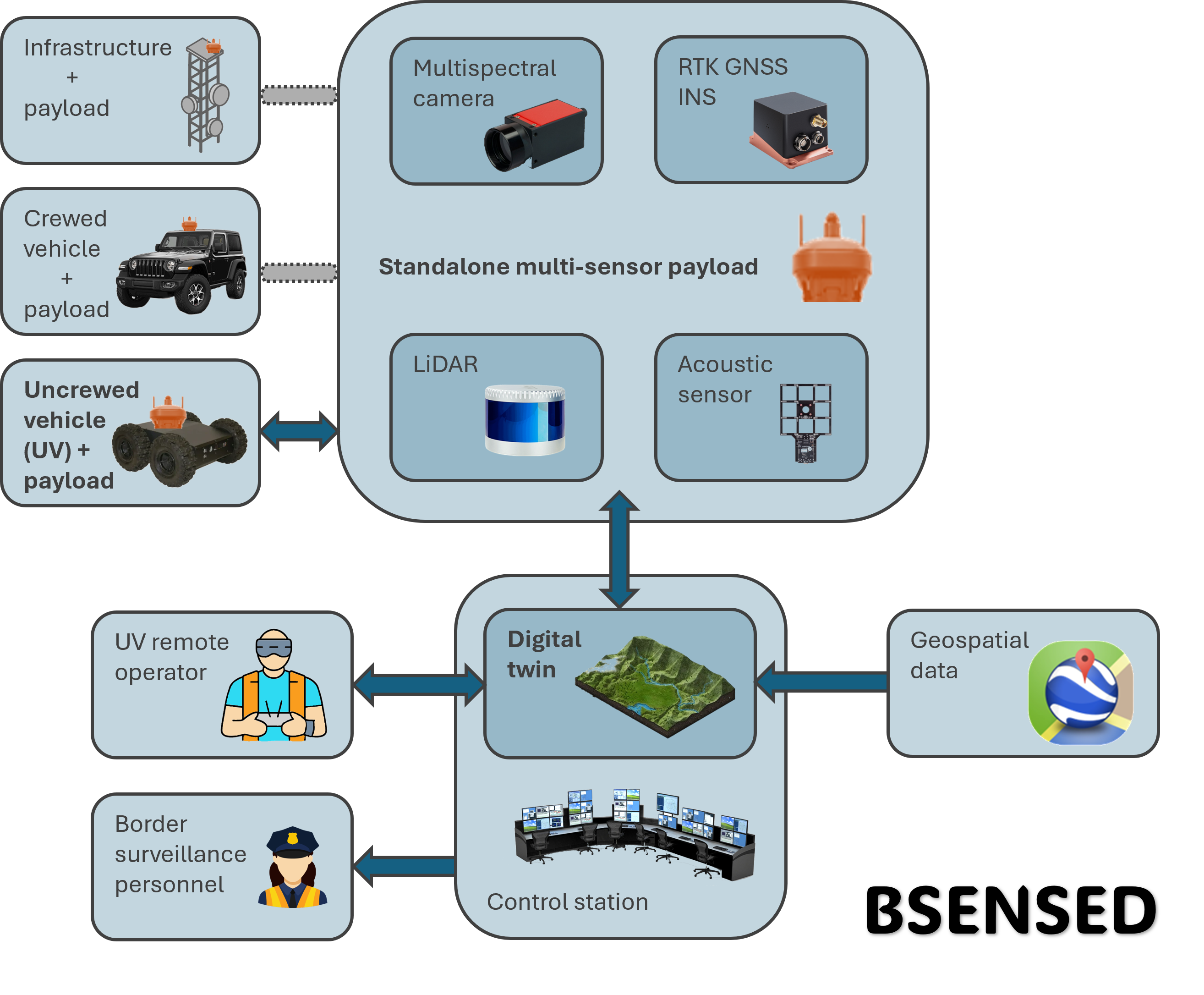
BSENSED proposes a framework for a digital twin from multi-sensor data for enhanced border surveillance and situational awareness. The digital twin foundation is geospatial data (e.g. Copernicus, Google Earth) complemented with multi-sensor data gathered from mapping equipment installed at surveillance towers or crewed and/or uncrewed vehicles. The BSENSED platform will allow updated mapping of the border area under surveillance, with immediate detection and localisation of people and vehicles, while also providing valuable assistance and training in complex terrain.
BSENSED project
Novelty
The proposed digital twin and standalone payload bundle have the potential to disrupt the infrastructure surveillance market by offering a unified platform with high data integration and visualisation capabilities. This innovation eases the efforts of surveillance teams, whether at command-and-control stations or in the field, to interpret and act upon the available information. The envisaged new platform demands significant computational power as well as data integration and synchronisation.
Expected Result 1
A standalone multi-sensor payload prototype with multimodal sensors, mountable on infrastructure or movable platforms, and capable of:
- multi-sensor data acquisition, integration and processing for digital twin update;
- automatic mapping of an area under surveillance; and
- automatic people and vehicles detection and localization.
Expected Result 2
A digital twin of an area under surveillance, that allows enhanced situational awareness of the area with updated information; abstract representation of detected people and vehicles; and training of remote operators of uncrewed vehicles, as well as assistance for safe remote operation.
News & outcomes
Check our News & Outcomes page for updates on the BSENSED project!